Showing posts with label Hiking. Show all posts
8/08/2010 12:57:00 PM

Day 76 (July 21, 2010)– Comet Falls

I had the afternoon off today, so I decided to hike to Comet Falls. Comet Fall is suppose to be the best waterfall in the entire park. I went hiking with two of my friends, Kelly and Steven.


We drove down to Comet Falls trailhead and started up the trail. About 0.3 miles up the trail we cross over Christine Falls. Christine Falls is a little waterfall that can be seen from the road so lots of tourists stop there.


From there we headed uphill for 1.3 mile to the falls. The falls just appeared out of the woods, and were amazing.


From Comet, we hiked up closer to the base and then up to the top of the falls. Where we say two Mountain Goats on the next ridge.

8/06/2010 06:24:00 PM

Day 72 (July 17, 2010)– Three-quarters of the way to Camp Muir

Since I had today off as well, I know it seems like I never work but I actually do on occasion. I usually work my hiking in around work schedule. Basically if I have free time, I am probably hiking.

So the goal for today was to hike to Camp Muir. Camp Muir is named after the naturalist John Muir. John Muir founded the Sierra Club and was a conservation supporter. John Muir visited Mount Rainer and my favorite story about him comes from this visit. His plan had been to just hike up a part way up the mountain, but in a letter to his wife he tells his wife pushing upwards and the next thing he know he is standing on the summit.

Camp Muir is a camp where climbers typically spend the night at before summiting the mountain. Camp Muir is about a 4.1 mile hike from Paradise. 4.1 miles seems like an easy enough hike, but it’s not. It is a grueling 4.1 mile hike with about 4,900 feet of elevation gain. Plus add in the sun beating up and down on you. Up on you, what am I talking about? SNOW! On the mountain you risk sunburn not just from the sun but its reflection off the snow so it is easy to burn your chin, underside of your arms, inside your shorts.

I knew from the beginning that this was going to be a grueling hike, but my hiking partner didn’t quite understand all this. It took us longer than I expected to make it to Panoramic Point, which is only 1.7 miles from the trailhead. The view was fantastic. It was a clear day so we could see(from right to left) Mt. St. Helens, Mt. Hood, and Mt. Adams. Mt. Hood is in the  middle-left and is very hard to see in the picture but it is there.
From Panoramic, we continued up the mountain. After about another hour of climbing we made Pebble Creek with is about half way there. We took a short break and then started working our way up the Muir Snowfield.

About half way up the snow field my hiking partner sits down and state “I refuse to go any further.” Needless to say I was disappointed but not surprised. She wasn’t in shape for climbing to Muir and was getting pretty sun burnt. So we turned around and headed back to Paradise.

As we were heading down, I decided that despite wearing shorts, I wanted to glissade down part of the snowfield. For those who don’t know glissading is a fancy name for sliding down on your but.

8/02/2010 06:23:00 PM

Day 69 (July 14, 2010)– Snow Lake, and a Scary Realization

Between work Breakfast shift and Dinner shift, I went hiking with one of the guys to Snow and Bench Lake. This was a short but good hike. So we drove out to the trailhead and started up this 1.6 mile trail. It was a fairly easy hike. It was uphill but not very steep. We passed though valleys of Avalanche Lilies (I will explain why they are called this in my next post, but they are a really cool flower). We passed by Bench Lake


After Bench Lake, we started to hit some snow but it was no big deal. After the snow, we made it to Snow Lake and it was amazing. We followed the trail to the point where they no longer maintain trail. Abe, the guy I was hiking with, asked me if I wanted to go around snow lake and me being me said sure. So we bushwhacked our way around the lake. About half-way around, it started to get really sketchy. At this point, I realized that if anything was to happen to me or Abe, I would NEVER be able to find another hiking partner on Mount Rainier.


Thankfully despite, a few close calls and falling though the snow once for Abe, and twice for me, we made it around Snow Lake and back to the trail.

7/25/2010 04:26:00 PM

Day 54 (June 29, 2010)– Olympic National Park – Hurricane Ridge, Crescent Lake, Sol Duc


Olympic National Park is amazing. I have a book on the National Parks of the United States, and it outlines ways to visit the park if you only have a few days. Today I was driving the Hurricane Ridge, Lake Crescent and Sol Duc path. I woke up this morning and I had picked a pretty cool place to sleep. From the campground, I drove up to Hurricane Ridge in hope in seeing Mount Olympic.


But alas, the mountain was clouded over. From Hurricane I drove toward Sol Duc. On the way I stopped Crescent Lake. Crescent Lake has a cool Indian story attached to it. The legend states the Mount Storm King, angered at the fighting between the Quileute and Clallam Indians, threw a boulder, killing the combatants and splitting the lake in two.


At Crecent Lake, I hiked to Marymere Falls.


After that hike, I drove up to Sol Duc and hiked a 6 mile loop called Lover’s Lane. This loop is named Lover’s Lane because if you are there at the right time you can see salmon mating. I was visiting at the wrong time. This trail also passes Sol Duc Falls.


My original park plan had me camping in the Hoh Rain Forest and then going to the beach in the afternoon. But low tide was in the morning, so I camped at Mora Campground, and ate dinner by the beach and watched the sunset. It was suppose to be a clear day, and I was hoping to see the green flash but no, and the I was hoping for a nice sunset but alas I go neither.


7/17/2010 10:19:00 AM

Day 49 (June 24, 2010)– The Dumbest Question I have been asked by a Tourist

Yesterday, on my hike I took a fully packed backpack so I could practice for my Wonderland Hikes. I was feeling lazy when I got back yesterday, so I waited until after work today to bring my pack up. I was bringing my pack up when a tourist stopped and asked me if I had just gotten back from climbing the mountain. This might not seem like a dumb question seeing as I was carrying a pack, but it was due to the clothing I was wearing. Drum roll please, I was wearing a short sleeved t-shirt, a pair of shorts and flip-flops. I really wanted to say “yes I climb the mountain in shorts and flip-flops” but alas I did not. Though I really wanted to.

7/17/2010 06:05:00 AM

Day 48 (June 23, 2010)–A Great Victory, and More Hiking

Today was the day, the U.S. verses Ghana game. This game determined whether the U.S. moved on to the next round of the world cup. It was a very stressful game because the U.S. could only guarantee they moved on by winning this game, they could move on with a tie as long as certain things happened. It took the U.S. over 90 minutes to win, but Landon Donavan scored and the U.S. moved on in there group and also won the group.

After the soccer game, I decided to go hiking up West Side Road and attempt to make it to round pass for the second time. I made it about a mile up the trail when I spotted this unmarked trail and decided to hike up this trail. I hike about a half mile up it and then realized that if I got lost no one would be able to find me due to being lost in an area I was not planning to hike. At this point, it was getting late and I knew I wasn’t going to be able to make it up to Round Pass so I headed back to my car.

7/17/2010 02:05:00 AM

Day 47 (June 22, 2010)– 6.5 Miles More Miles Down

     Another section of Wonderland down, I had been wanting to hike from Narada Falls to Box Canyon for a while, but there had been some flood damage so I couldn’t do a couple of weeks ago. This hike was 8.9 miles including 2.4 miles that I had already done but it was a lot of fun.

     This hike needed to be a two car shuttle hike so I found another person to hike with who had a drivers license and borrowed Bree’s car. We dropped the cars off and started out hike. The hike immediately got interesting when the patches of snow went from nothing to 5 feet high and we had to climb up and down them. Once we got up the incline, the trail evened out but we lost the trail completely so I had to get out my compass and navigate that way. Once we found the road we were golden. From there we hiked by the still frozen reflection lakes. From there we followed the road since the trail was under snow and we couldn’t find it. When we found the trail again, we could see about 10 yards of it and then attempted to follow it though we lost it shortly after finding it again. This made the rest of the trek downhill very interesting. Basically, we hike downhill thought the branches, trees, and brier bushes until we found the road and the next part of our trail.

     Once we found the trail again the going was easy. We hike past Martha Falls. I was hoping to see a bear near there. A couple of sightings have occurred there. But alas no joy on that endeavor.

     From Martha, we marched on. From there I rapidly realized why, I was told not to hike this trail earlier. At several places there were visible signs of landslides.
     From there we crossed over to Maple Creek Camp to the section of Wonderland I had already hiked. This section was just like the last time just without the snake. Though we did get a really cool sighting that I don’t have pictures of which was two elk and a calf.

6/19/2010 07:33:00 PM

Day 34 (June 8, 2010)– More Wonderland and two repeat trails

     Today, I went hiking with one of the Singaporeans, Jonathan. I call him John for short. I think he is my favorite of the Singaporeans. I decided that we were going to hike a short section of Wonderland that I knew the trail conditions on were not bad. By short I mean 2.4 miles. We started out at Box Canyon. Box Canyon is a canyon carved by a glacier and has a glacier stream running through it. One of the interesting things about this canyon is the rocks have been polished by the glacier.

     The plan was to hike from Box Canyon to Maple Creek Camp and further if the trail condtions where ok (the rangers said they weren’t but we were going to see). So we started our hike, and about a half mile into it we saw two black-tailed deer. They ran away to fast for me to get there pictures. They were not the most intresting thing we saw. The next animals we saw were two elk. They were out of photo range. But still not the most amazing sight, well really it was a surprise seeing as I almost stepped on it. Now what did I almost step on you might ask. A snake, yes a snake.

     I was talking to John when I took a step and as I was taking my next step I noticed this snake in my path so I jumped backwards. My first thought was “I almost stepped on a snake and is it poisonous” and my next thought was “wow, this is cool.” (I was pretty sure upon looking at the snake he wasn’t poisonous but I checked with a ranger when I got back and found out he is a common _____________) Past the snake, we continued to follow the trail to the Maple Creek Camp Site. At the site we ate lunch and then followed the trail a bit further. However, we meet a slight problem. The problem came in the form of a rather large creek. I would be just fine wading it with my water proof boots, but John was wearing tennis shoes. So we decided not to cross the stream.

     We turned around and headed back the way we came, sort of. Just after the bridge we passed on the way to the campsite the trail forks and heads to a river view point. We decided to take a different route back to my car. Part of this route involved hiking up the road, but that was so much fun because we could stop and enjoy the scenery that most people drive right by.

     After we got back to my car, we had plenty of time so I took John out to hike Grove of the Patriarchs and to Silver Falls. Though this time I took the short .3 mile trail out to Silver Falls rather than the 2 mile loop.

6/13/2010 06:08:00 PM

Day 30 (June 4, 2010)– Hiking Problems

     Nothing new to report on the avalanche.

     Today I just worked a breakfast shift. This meant that I had the whole day to myself. It was rainy and cold so I wimped out on hiking. Though that was only part of the reason, I have now hiked every trail that is completely or mostly snow free. The rangers at the Jackson Visitor Center know who I am and the one guy has learned the trails I regularly ask about and no longer has to look up the trail conditions of the trails I really want to hike. Since I couldn’t and wouldn’t go hiking, I went to Longmire and used the net for a couple of hour and then hung out with the Singaporeans for the rest of the day.

6/13/2010 05:48:00 PM

Day 29 (June 3, 2010)– West Side Road Hiking and Tragedy on the Mountain

     Today I worked the Breakfast and Dinner shift which means I have a long break in the middle. The weather today was amazing perfectly clear from 6:00 a.m. to mid evening. I could see the mountain for the first time in like a week, so I had to go hiking. I decide that I was going to hike as far as I could up the West Side Road of the Park. You might as why I was hiking a section of roadway, well Mount Rainier has a problem of the glacier feed creeks flooding and ruining the roadway. Currently two of the parks roadways are closed due to flooding damage, West Side and Carbon River. Both of these closers create a problem for hiking the Wonderland Trail (but I will go into that at a later date). So the only way to get up the see the West Side Road is to hike up it. I had about 4 hours to hike and 45 minute drive each way. I wasn’t going to have time to hike the entire road (its 12 miles long but I could do part of it). I started up the road and the first thing I came to was the word “bear” and an arrow drawn on the trail so I had to spend a couple of minutes looking for the bear. No, I didn’t see it. I continued up the road and for the first quarter mile was wondering why the road was closed it looked pretty good to me but then again I grew up driving up and down a gravel driveway. After a quarter mile, I understood why the road was closed. The river had created a couple of gullies that most vehicles would not be able to cross though those with high ground clearance could make it.
      The next part of the trail was all up hill. About three quarters of the way to my goal, I realized that it was 2:00 p.m. and I had to be at work at 4:30 if I wanted time to eat before shift. So I turned around and headed back (I didn’t want to but I am here to work). I made it to work on time and with time it eat before shift, but just barely. On the hike, I had noticed a helicopter flying around the top of Mount Rainier. While I was eating I found out the cause of the helicopter, it was an avalanche on Ingram Glacier (I know my mother has posted that I was ok and not involved in the avalanche). The early counts had 11 groups on the mountain at the time of the avalanche. Later in the day, we found out that most the parties had made it down ok. Including one commercial group that turned back shortly before the avalanche. At night fall, the rumor had 6 buried and dug out, and 1 still missing.

6/11/2010 05:45:00 PM

Day 27 (June 1, 2010)– Sliver Falls and Grove of the Patriarch

     After much debate with myself and a ranger’s recommendations, I decided to hike two trails, Silver Falls and Grove of the Patriarchs. They are connected by a 1 mile long trail so I was going to combine them into one hike, however on my way out to the trailhead I got a little distracted. I got about 2 minutes down the road from Paradise when I spotted a fox lying on top of an embankment by the road. I figured I would take a few minutes and take some pictures. I ended up spending an hour and a half watching this fox. Ok so most of you are saying it’s just a fox. You were right until I noticed something pocking its head out from a small crevice at the base of the embankment. This changed the course of my day.

     Yes, that is a kit (baby fox). This is the reason I got distracted. The kit kept sticking his head out of the hole like he was going to come out, so I decided to wait for him to come out. As I was being quite and waiting for him to come out, I was keeping an eye on the mom. Out of the cornor of my eye, I see mom get pounced by this black thing. It was a second kit. The first one still hadn’t come out of his hole, so I was watching the kit run around. Then all of a sudden a the second kit is tackled by a third. This sight kept getting better. As the second and third kits were playing, I noticed a fourth kit watching. I continued to watch and was thinking, this is a lucky sight and since I know where the den is, I can easily come back. About this time the first kit, decides to join the other three. They four of them start running around and playing. I couldn’t believe it, I just started holding the button down on the camera to get as many pictures as possible of them.

     After an hour and half of watching them, the mom decided that I much have some food and decided to approach me. At this point I left. From there I drove out to my trailhead on the eastern side of the park.

     I started on the Silver Falls Trail. The trail first goes past a hot spring. From there the trail follows a large creek or small river. After about a mile, Silver Falls appeared. Silver Falls gets its name from the color of the water. The falls is fed by an active glacier so the water is white in color.

     It was getting late in the day so I decided to hike straight back to my car rather than hiking the additional 3 miles to the Grove of the Patriarchs. After I made it to my car, I drove to the Grove of the Patriarchs. I know this is cheating but it was getting late and I didn’t want to be hiking at dusk in cougar country alone.

     When I got to the Grove of the Patriarchs, I decided that I would hike the 1.1 mile loop. The loop follows a crystal clear stream. This spring is feed by an inactive glacier so it doesn’t have the white material that other streams are plagued with. After a short walk, the trail crosses a suspension bridge to a large island.

After the bridge, I entered the Grove of the Patriarchs. Grove of the Patriarchs is a stand of tree that is over 1000 years old. These trees were over 150 feet tall and an diameter of 5 feet. It was very impressive.

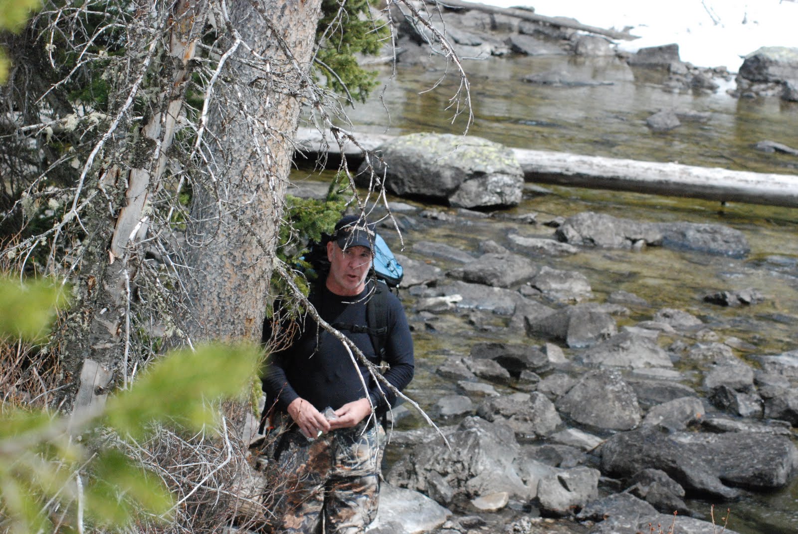
On my way back, I ran into some of the other employees from Singapore. They were amazed I was hiking by myself, but I didn’t think it was that big of a deal. We talked for a bit and then I went back to my car and headed back to Paradise.

6/08/2010 06:55:00 PM

Day 26 –Pay Day and Day Off Planning

     Today I got my first pay check. This was great other than they messed up, on charging me room and board. I am working on getting it straightened out but we will see how long it takes. I have the next two days off, so most of my time is spent trying to figure out what and where I want to hike.

     My current plan without taking to the rangers about trail conditions is to drive down to the east side of the park and hike the section of Wonderland Trail that runs from Box Canyon to Narada Fall then up to Paradise and then find someone to drive me back to my car, or if that is not possible hike to Pinnacle Peak (which is in the Tatoosh Range and then go to the top of the Tatoosh).

     After talking to the rangers both trails were ruled out. Wonderland due to flood washout and Pinnacle due to avalanche risk. So I am still kind of up in the air about my first day off. The second day I am going to Pullayup and get some new work shoes.

6/05/2010 05:50:00 PM

Day 22 – Paradise to Longmire

     Today was an interesting day. I was scheduled to work both lunch and dinner today, but after lunch. The assistant manager Kyle told me I was getting to close to overtime so he gave me dinner off. I talking to the new busser, Anna, and she was looking for someone to hike with and somewhere to hike.

     Since I now had all this free time, we decide to go hiking. The next step was to pick a trail. One of the trails runs from Paradise to Longmire and the bottom half of the trail is part of Wonderland, so it was high on my must hike list. I suggested it and we went over to the Jackson Visitor Center (JVC), to talk to the rangers about the trail conditions. She told us that we definitely need snowshoes if we didn’t want to posthole the first half of the trail. (Potholing is taking a step and sinking knee deep or more into the snow) So Anna and I borrowed snowshoes from the JVC and went on our way down the mountain for a 5 mile trek. The trail could really be divided into three sections: Above Canyon Road, Below Canyon Road, and Wonderland.

     The above canyon road section was a little tricky due to the fresh snow and the inexperience using snowshoes on both mine and Anna’s part. We followed this creek down. The creek was really intresting because it was flowing though a 5 foot canyon of snow.

     We made it too canyon road, and stopped to take picture of us on top of the snow bank before starting the Below Canyon Road section.


     There was only one problem. We couldn’t find the trail head for the next leg of our journey. The Above section had been marked with poles but not the below. Since the creek had gotten bigger, we didn’t want to just wing it down the mountain because knowing my luck we would end up on the wrong side of the creek. So we hiked down the road, instead of the trail to the Narada Fall, which was the starting point for the section of Wonderland we were going to hike.

    We made it to Narada, and started down the mountain. As we got below the falls, we had some gorgeous views if the falls. Since this trail is less traveled finding the trail at points was hard and sometimes we came to forks in the foot prints we were fallowing and had to pick a direction. We both decided that bridges were a good sign we were going the right way. On the other hand some bridges presented a challenge on how to cross them. The snow was 5 feet deep in places and was melting of the bridges so sometimes we had a 5 foot vertical drop to get down to the bridges. On those, we walked down to the creek and rock hopped across it was safer. On another bridge, we walked across the snow so we were about 10 feet up from the creek bed.

     From the bridge the snow started to disappear, which was really nice. The trail then passed through one of the large glacier fed stream bed (I wish I had pictures but we were in a hurry because we were running out of time to make a shuttle back up the mountain). The last section of the trail was though the a grove of old growth forest, but this wasn’t my favorite part. Anna and I were chatting away when we came across a Black-Tailed Dear about 15 feet away from us. This was cool, but my favorite part was the deer tracks we came across. First we saw the deer tracks, the deer was simply walking down the trail, and a little while later there were cougar tracks on top of the deer. As we continued to walk we could watch the tracks spread out as the cougar chased the deer. No, we did not see the cougar, though I wish we had.

With a 1 minute to spare we made it to Longmire and out shuttle back up the mountain.

Here are the rest of the pictures from this hike, click here

Wonderland Progress

6/04/2010 05:34:00 PM

Wonderland Trail

Wonderland Trail is a 93 mile trail that circles Mount Rainier. Most people thru hike the trail in anywhere from 24 hours to 2 weeks. Most people take between 8 – 10 days. Now, I know some of you are saying no one can hike 93 mile in 24 hours. You are right but some did run 93 miles in 24 hours.


My main goal for the summer is to hike all of Wonderland Trail. I am not going to thru hike it, I am going to break it up into one day sections or an overnight whenever possible. One section of the trail, I will have to take days off work in order to hike because of glacier flooding washing a road out. This is my big goal for the summer. Here is a map of Wonderland Trail. The trail is in yellow and I will highlight the sections I have hiked in other colors

6/03/2010 05:28:00 PM

Day 20 – Rampart Ridge

     Today was my first day off since my arrival. I decided that I was going to go hiking. I decided to hike a loop called Rampart Ridge. Rampart Ridge is a 5 mile trail. I though 5 miles isn’t that long of a trail. Yea, I was wrong. In the first .5 miles of the trail was part of a small trail called Trail of Shadows.

     Trail of Shadows is a easy trail that runs though some mineral spring and the resort built by the Longmire family. The history in the trail was fairly interesting. My favorite part was the spring that the resort claimed could heal any illness and the sign next to the spring read “DO NOT DRINK – the water can make you sick.” That is really ironic.


     From there the trail goes upward 1,200 feet over the next mile. It was a fairly hard climb for me because I am still not fully adjusted to the change in elevation. The weather had been fairly iffy to begin with and as I reached the top of the ridge it started to rain. So the view from the top of the ridge was kind of sucky. Though I could tell on a clear day it would be amazing. But the forest on the way up was so lush and green.


     From the view point the trail heads down the other side of the ridge and connects with the, drum roll please, Wonderland Trail (for those that don’t know what Wonderland is, I will be going a separate post on it in a few days). The small part of Wonderland I did hike (1.4 miles) was all downhill so it was fun.

To see all my pictures from this hike click here.

5/11/2010 09:51:00 AM

Day 5 – Grand Teton National Park

     Today was my first day in Grand Teton National Park. My day started later than I planned, due to my sleeping though my alarm. Thankfully, I didn’t sleeping though the whole day, I only slept until 9:00 a.m. I got the park and my first stop was the visitor center to see how the road conditions were. I asked one of the rangers about a good 6 to 8 hour hike that I could get to in my without four wheel drive and snow tires. He suggested the Jenny Lake Loop to Hidden Falls. He told me the roads that were open were snow free, so I would be good on that concern.
     I drove out to Jenny Lake and immediately encountered snow on the hiking path. I have never experienced hiking in snow and needless to say I was underprepared for the difficulties in hiking in snow and 7,000 feet. At certain points I was knee deep in snow.

     I made it about half way to Hidden Falls when I slipped on a snowy embankment and twisted my ankle. At that point I decided it was safest if I turned about and head back to my car. The close I got to the car the more my ankle hurt and it got the point I was just saying to myself “one more step and I am one step closer to being done.” At one of my rest stops, I heard this twig snap and looked up and there was an adult moose. The moose just looked at me like I was crazy and continued to eat his twigs.

     From Jenny Lake, I drove further into the park. The next stop was a overlook on the other side of Jenny Lake. At this overlook, I met an older gentleman, who was looking for someone to go snowshoeing with. My ankle was feeling better so I went with him about a mile. 
     Yesterday, this gentleman had found three wolves feeding on a kill further into the park. I followed him out to this spot and we started watching. The first thing I noticed was a heard of elk near the spot he had seen the wolves. As I was watching the elk, they took off running and I noticed a gray wolf bounding behind them. The wolf didn’t catch an elk, but it was still cool to see. The wolves then spent over an hour feeding on the same kill as yesterday.
     After the wolves, I spent the next two hours exploring the park and just viewing the sights. I will try to post pictures soon. But I have to go through 442 pictures. 
Animal Count:
  • Moose – 3
  • Elk – to many to count over 100
  • Otter – 2
  • Wolf – 1 (A ranger confimed this was a wolf, it was wearing a radio collar)
  • Muskrat – 1
  • Coyote – 2 (I am not entirely sure they were not wolves but coyotes are more common)
  • Bison – 15
  • Many types of birds

4/04/2010 08:32:00 AM

Hiking Boots Adventure

     For this summer, I need new hiking boot. My old ones are really only suitable for day or overnight easy hiking, and this summer I plan to hike the Wonderland Trail (94 miles) and many of the other trails in Mount Rainier. On to the adventure, Gainesville lacks a good place to buy hiking boots, and the nearest REI store is located in Atlanta, GA (4 hours drive), and the nearest Gander Mountain is in Ocala, FL (1 hour drive). So on the way to my friends house in Orlando, I was going to stop and pick up some boots. This simple plan went wrong very quickly. The first issue was a wreck on I-75, so we took the back roads to Ocala. The next issue was finding Gander Mountain. According to their website, the store was located right off the interstate. It was, but it was hidden behind a couple of building and missing a sign by the road.
     Once in the store, my boot choices were quickly narrowed down to two boots:

  • Timberland® Chocorua Trail-Hiking Boots
  • Vasque® Boreas GTX Women's Hiking Boots  
     Both boots were light weight and water proof. They were the same style boot that provided ankle support. I decided on the Timberland boots, because they were slightly lighter and had a better fit. Also, while at Gander Mountain, I got hiking socks and liners.